Friday, May 31, 2013

Ecuador Part 1 - Quito

To celebrate my unfortunate arbitrary age-related milestone of 30, we decided to take advantage of Canada's centralized location and spend 10 days in Ecuador.  Our Spanish isn't great, so we booked through a company that organized our accommodation and transfers, and provided English-speaking guides to us when necessary.  (Not a tour group, just us.)

We arrived in the capital Quito - the highest capital city in the world at 2800m above sea level and already nearly 600m higher than the highest point on the Australian continent.  Cue altitude sickness on day 1! 

A panorama looking over the Old Town.  The city's built around numerous hills and valleys, and driving around is an exercise in trusting your mechanic.  There are plenty of cobblestone streets leading to Spanish-style houses with brightly painted walls.

The statue that you can just see on top of the hill in the photo above is a much bigger replica of a small sculpture called the Virgen de Quito.  Apparently it's famous because it's the only depiction of Mary with angel wings.  It's a very Catholic country - 80% Catholic - so there were churches and religious iconography everywhere.


We visited 3 of the major churches, only one of which we have photos of.  This is the Basilica del Voto Nacional (Basilica of the National Vow) which is a huge neo-Gothic style church.  

The coolest part of this church was that the gargoyles are native Ecuadorian animals - iguanas and caimans here, and elsewhere armadillos and giant tortoises.

A stained glass window from inside the church.

 Looking down the length of the church - it was really large although standard churchy-type stuff inside.

We lucked into touring the city on the day when the President was making an appearance on the balcony of the presidential palace.  You can see the guards in the Ecuadorian national colors of yellow, blue and red.

Marching guards.

Guards riding oddly-dressed horses.  There were a lot of people visiting to see the President.  This President has apparently just started his 3rd term, but before that there was a lot of political upheaval.  It was interesting to discuss the political situation with our guide.

 The Church and Monastery of St Francis, a beautiful old building.

The weather changed fast in Quito - stormclouds building over a park we visited.

The locals didn't seem to care about the stormclouds - it rained so frequently that if you did, I think you'd spend your life inside.  We ran into lots of people playing volleyball all over the place (soccer too, although that was expected).  They're playing on concrete - ouch.

Ecuadorian food was surprisingly tasty!  Here's a sample plate with pork, empanadas, fried banana and llapingachos (fried mashed potato cakes with cheese inside).

Goat stew with rice and potato.  Also delicious.

This is Part 1.  Part 2 (Galapagos Islands) and Part 3 (Highlands) are also available.

Saturday, May 18, 2013

Vicki's 30th Birthday

Last weekend was my 30th birthday - to celebrate, we're travelling this weekend to spend 10 days exploring Ecuador and the Galapagos Islands.  We're really excited!  We did a few things for my actual birthday as well, photos below.

My Mum sent a birthday care package from Australia with 30 Aussie items for us, including Tim Tams, Nutella, Vita Brits and Anzac Biscuits.  Awesome!

Stephen bought me a beautiful Tiffany necklace too :)  

We had a BBQ in the park with some friends to celebrate as well - unfortunately the weather was a bit colder than we'd have liked, but we still had fun.   

Our friend Andy bought her two Shibas, so there were three Shibas there!  One of each color.  Here they are all trying to beg sausages! 

Jax and Andy's dog Momo love chilling out together.  Here they are watching the stupid humans do silly things.  Momo is much smaller than Jax!

Tomorrow afternoon we fly to Quito, and then on to the Galapagos Islands.  Wish us luck! 


Monday, March 25, 2013

Utah Part 3: Bryce Canyon and Zion National Parks

The next day, we headed over to the highlight of the trip - Bryce Canyon and Zion National parks.  

Bryce Canyon is actually not a canyon at all, but a series of ampitheatres on the side of a plateau (thanks Wikipedia).  It's famous because it's full of these strange rock formations called "hoodoos", which are caused by natural erosion of the sandstone.   

Hoodoos!

More hoodoos!

The pictures don't really do it justice, it was pretty impressive though.

Snow-covered hoodoos.

This hoodoo is called Thor's Hammer, for obvious reasons.

On our way out of the park we saw some deer.  Their huge ears look almost rabbit-like!

After leaving Bryce, it was on to Zion National Park.
The road in.  Zion Park contains a huge canyon that you can drive into and along the bottom of, surrounded by huge canyon walls that look like mountains from the bottom.  The walls are 800m high.

Like the rest of the area, it was formed by erosion of the sandstone.  Here's Stephen standing next to a huge rock called Checkerboard Mesa, again, for obvious reasons.

While we were there, we decided to do some hiking - we thought we'd go to the top of this canyon wall.  It's called Observation Point, and it's 700m above the canyon floor.  It's a 13km round trip.  It was a pretty difficult hike.

This is from the start of the hike.  In the bottom-right of the picture, you can see our car!  It looks tiny already, and we were only about 30 mins into a 4 hour hike.

Climbing a bit higher!

We got up by walking up a series of switchbacks cut into the rock.  We were walking uphill nearly the entire way, which was pretty tiring.  Walking back down afterwards was actually just as bad, as it's bad for your knees and also if your toes hit the front of your shoes.

6.5km horizontally and 700m vertically later, we'd reached the top!  It was a pretty amazing view, even if we were a bit scared of the edge :)

Amazingly, we were on the trail that was for people who were scared of heights - and it was still a 2m wide trail with a sheer drop-off on one side.  The walk we didn't do was called Angel's Landing, which is a lot shorter and about half as far up, but the last half a km of the hike is on a path that's about 1.5m wide with a 300m drop on both sides - neither of us is particularly fond of heights, so we opted to give this one a miss (the hike we went on was scary enough!).  You can see the little people climbing on top of Angel's Landing in the picture here - this is the rock that's in the center right-hand side of the above picture.

Observation Point was home to a bunch of very tame chipmunks, who had absolutely no fear of people and would run right up to you and steal your nuts and muesli bars.  Cute!

Part of the trail goes through a slot canyon in the rock.  On the way back down, Stephen decided that his feet were hot and that he wanted to dip them in the sluggish river that runs through the canyon.  Apparently no one told him that the river is fed by snowmelt.

We stayed overnight in the park, and the next day went for a few shorter hikes (sore legs!).  A famous hike in Zion is called "The Narrows", which essentially hikes through a canyon for 26km.  The catch is that the river that carved the canyon is still there, for you're hiking up the river for most of the route, and swimming some parts.  This is the start.  We saw some people starting the hike while we were there - as I mentioned above, the water's not warm!  They were in dry-suits (sealed outfits that don't let the water in) so that they didn't get hypothermia.  It sounds like a pretty crazy hike, although I think I'd much prefer to do it at the end of summer when the water is a bit warmer!

On our way back to Las Vegas airport, we stopped off in the Valley of Fire State Park for a bit of a nap and to check out the rocks - because apparently you can never see enough rocks on a vacation!  After Zion and Bryce it was fairly unspectacular, but the interesting part is that it's often been used as a backdrop for Star Trek - particularly the original series.  You can see how it looks vaguely alien.

And with that, we headed back to Vegas to catch the red eye back to Toronto.

This is Part 3, the last post from our trip to Utah - you can go back and read Part 1 and Part 2 if you like.

Sunday, March 24, 2013

Utah Part 2: Antelope Canyon and Horseshoe Bend

The next day, we drove west to a place called Antelope Canyon, that Jess and Luc wanted to visit.  It's a slot-canyon, formed by flash floods which have eroded the sandstone away over time to make wave-like shapes.  It's hard to capture in pictures, but I've put a few in here.

The walls were very close in on both sides.

There were beautiful flowing patterns in the rocks.

A person in the bottom left corner, for scale.

Jess apparently neglected to tell us before going in that 11 tourists died in a flash flood in the canyon in 2006.  I wasn't so sure this was a good idea after I heard.

More pretty colors.

Jess has provided me with an extra picture from her DSLR camera which shows the colors much more nicely than our little point-and-shoot.

We stopped for a quick lunch at Denny's (diner food) after making it safely out of the canyon without dying in a flash flood (thanks Jess).  They had a promotion running called Baconalia! (including the exclamation mark), which included Maple Bacon Sundaes, Maple Bacon Milkshakes and Salted Caramel Brownie Sundaes with Bacon.  I didn't have one as I didn't want to have dessert on my own... but I am deeply regretting this decision.

We visited Horseshoe Bend, which is a section of the plateau that has been carved out by the Colorado River over time.  I walked right up to the edge before realizing that it was a sheer cliff from where we were standing all the way to the bottom (and then ran away screaming).  For scale - that's a boat in the bottom left of the photo.

Jess and Luc weren't as scared of the edge as we were.  They visited Texas before coming to Utah, which apparently transformed Luc into a cowboy during their short visit.  Oh dear.

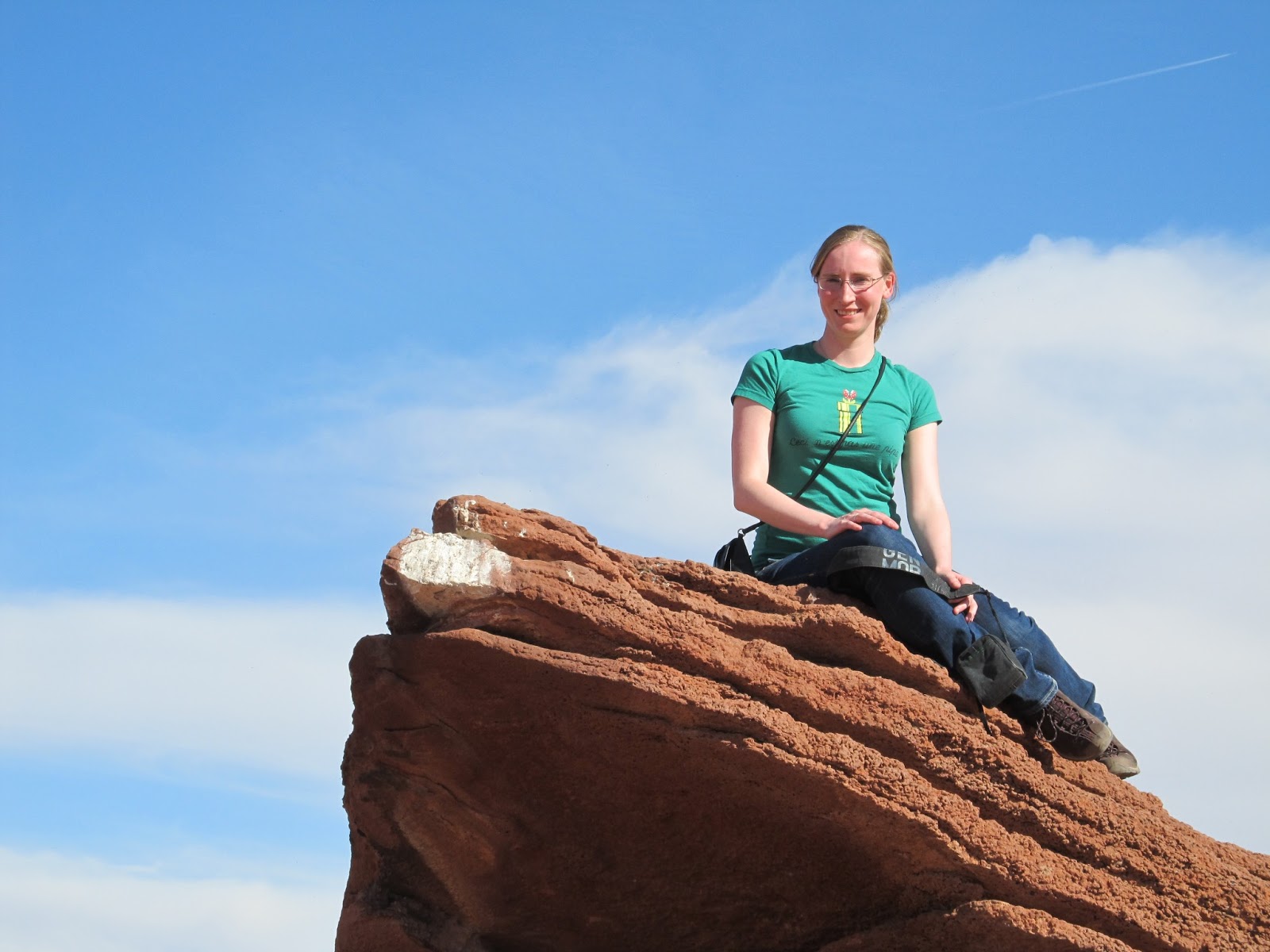
I often hear complaints that there aren't any photos of me on the blog, so here's a photo of me sitting on top of a rock.

Apparently this is what most deserts look like - the desert of your imagination that is nothing but sand stretching for miles apparently only really exists in the Sahara, and most deserts have enough water to support really stubborn shrubs like these.

Also in this trip series - Part 1 and Part 3.

Utah Part 1: Monument Valley

Our friends Jess and Luc were visiting the USA from Sydney, so we decided to fly over to meet up with them for part of their travels.  We flew into Las Vegas (direct flights from Toronto and only $400 return!), and the next day drove 650km across southern Utah and northern Arizona to meet them in Monument Valley, which is on the border of Arizona and Utah.  

I'd booked our car through a Hotwire mystery deal, and it ended up with Hertz.  At the airport, the staff member tried desperately to upsell us on everything - a better car, insurance (that we'd already purchased), fuel, GPS... and as a final act of revenge when we declined every upgrade, she took our booking for an economy car and instead put us in a compact car with no numberplates and a temporary registration sticker, that Stephen could hardly fit into. We ended up getting pulled over for the lack of numberplates by a Sheriff in Utah (where it's illegal), but luckily he was swayed by the "stupid Australian tourist" persona and didn't put us up on charges for it.  Hertz - jerks.

Anyway, eventually we made it to Monument Valley.  You might not recognize the name, but you probably recognize the view.  It's a series of sandstone buttes that jut 300m out of the plateau at random.  These two are called The Mittens... for obvious reasons.

They're pretty big.  That's a 4WD and a person at the bottom of the photo, for scale.  We drove around on a ~20km off-road track through the desert to see them all.  Luckily Jess and Luc had fallen for the upsell from their car rental check-in person and had a huge 4WD car, as I am not sure that the tiny compact car would have been great at 4WDing.

Monument Valley is on Navajo Native American land.  The buildings you can see in the foreground are hogans, which is the traditional way of living for Navajo people.  They are basically wood and packed mud and earth, and the doors always face east to welcome the sun.  Apparently they're the first real energy efficient homes, as the construction meant that it was cool in summer and kept heat in in winter.  

There were wild horses randomly wandering around in the desert, like this poseur.

It's very flat apart from the buttes, which looks pretty crazy when you get to any sort of viewing place.  That green speck in the lower-middle of the picture is a house.

Hey look, it's us!


We stayed at a lodge overlooking Monument Valley.  Jess and Luc wanted to make the most of their holiday in Utah (and are also slightly crazy), so they made us get up at 7am so that we could get a headstart on the day.  I wasn't impressed by the early wake-up time (well I was on vacation!), but we were awake in time to watch sunrise over Monument Valley from our balcony, which was pretty good compensation for the early start.

Trip continues in Part 2 and Part 3.